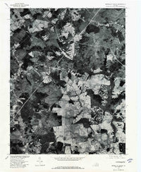
1977 Map of Boswells Tavern
USGS Topo · Published 1982About this map
Boswells Tavern and the surrounding rural landscape of Louisa County are captured in this orthophotograph, providing a photographic record of the terrain as it appeared in the late 1970s. The map illustrates a patchwork of agricultural fields and dense forest, characteristic of the Virginia Piedmont. The headwaters of the South Anna River and the waters of Lake Gordonsville provide the primary drainage for the region, while smaller features like Nolting Pond and Wheeler Creek sit among the rolling hills. Small crossroads communities and historic settlements such as Waldrop, Meltons, and Whitlock are identifiable by their clusters of structures and intersecting roadways, reflecting the enduring local settlement patterns of central Virginia prior to more modern residential expansion.
Find a feature on this map
8 named features on this map. Tap any name to fly to it.
Don’t see what you’re looking for? This feature index may not catch every label — zoom into the map to look around manually.
Map Details
Editions of this 1977 Boswells Tavern Map
This is the sole edition of this map. No revisions or reprints were ever made.
Other maps of this area

1891 · Palmyra
USGS Topo · 1:125,000

1892 · Gordonsville
USGS Topo · 1:125,000

1895 · Palmyra
USGS Topo · 1:125,000

1897 · Palmyra
USGS Topo · 1:125,000

1935 · Charlottesville
USGS Topo · 1:62,500

1939 · Charlottesville
USGS Topo · 1:62,500

1943 · Scottsville
USGS Topo · 1:62,500

1946 · Scottsville
USGS Topo · 1:62,500

1947 · Roanoke
USGS Topo · 1:250,000

1949 · Charlottesville
USGS Topo · 1:250,000