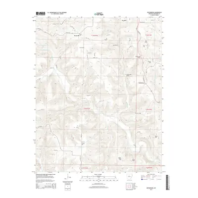
2014 Map of Botkinburg
USGS Topo · Published 2014About this map
Dennard and Botkinburg anchor this segment of the Arkansas Ozarks along the highway corridor, where the terrain breaks into a complex network of ridges and hollows. The drainage patterns of Archey Creek and Hartsugg Cr dictate the local geography, carving paths between prominent elevations like Clinton Mtn and Crowell Mtn. This landscape is marked by small-scale rural development, with scattered family cemeteries such as Lunceford Cem and Woolum Cem serving as significant landmarks for genealogical research. The map captures a moment of modern rural life where traditional names like Zack Hollow and Chinkapin Ridge persist alongside established water bodies like Jackson Lake, illustrating a enduring relationship between the community and the winding creek beds of Akins Cr and Boyce Cr.
Find a feature on this map
65 named features on this map. Tap any name to fly to it.
Don’t see what you’re looking for? This feature index may not catch every label — zoom into the map to look around manually.
Map Details
Editions of this 2014 Botkinburg Map
This is the sole edition of this map. No revisions or reprints were ever made.
Other maps of this area

1892 · Marshall
USGS Topo · 1:125,000

1892 · Mountain View
USGS Topo · 1:125,000

1894 · Mountain View
USGS Topo · 1:125,000

1894 · Marshall
USGS Topo · 1:125,000

1901 · Marshall
USGS Topo · 1:125,000

1956 · Russellville
USGS Topo · 1:250,000
1962 · Canaan
USGS Topo · 1:24,000

1963 · Leslie
USGS Topo · 1:24,000

1964 · Russellville
USGS Topo · 1:250,000
1965 · Rex
USGS Topo · 1:24,000