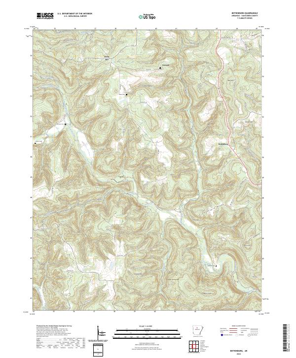
2024 Map of Botkinburg
USGS Topo · Published 2024About this map
Archey Creek and its many tributaries, including Akins Creek and Hartslugg Creek, define the drainage patterns of this Van Buren County landscape. Small settlements and crossroads like Botkinburg and Dennard anchor the local geography, connected by a network of winding roads such as Peyton Mountain Rd and Rocky Hill Rd. The terrain is characterized by prominent elevations like Chinkapin Ridge and Clinton Mtn, with local family history preserved in numerous burial grounds including Lunceford Cem and Woolum Cem. The map reveals a rural Ozark character where ridges and hollows, such as Zack Hollow, dictate the placement of homes and small community centers. Genealogists will find value in the specific placement of these cemeteries and named homestead areas like Rocky Hill and Salem Gem during the early 21st century.
Find a feature on this map
69 named features on this map. Tap any name to fly to it.
Don’t see what you’re looking for? This feature index may not catch every label — zoom into the map to look around manually.
Map Details
Editions of this 2024 Botkinburg Map
This is the sole edition of this map. No revisions or reprints were ever made.
Other maps of this area

1892 · Marshall
USGS Topo · 1:125,000

1892 · Mountain View
USGS Topo · 1:125,000

1894 · Mountain View
USGS Topo · 1:125,000

1894 · Marshall
USGS Topo · 1:125,000

1901 · Marshall
USGS Topo · 1:125,000

1956 · Russellville
USGS Topo · 1:250,000
1962 · Canaan
USGS Topo · 1:24,000

1963 · Leslie
USGS Topo · 1:24,000

1964 · Russellville
USGS Topo · 1:250,000
1965 · Rex
USGS Topo · 1:24,000