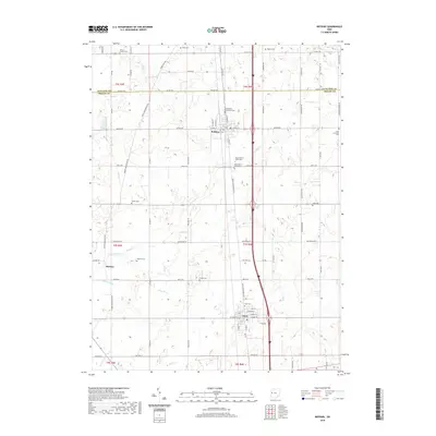
2019 Map of Botkins
USGS Topo · Published 2019About this map
Loramie Creek and its various tributaries, such as Hulls Cr and Muddy Cr, define the drainage patterns of this rural landscape spanning the border of Auglaize and Shelby Counties. The village of Botkins sits near the northern boundary, serving as a focal point for the surrounding agricultural region. Further south, the town of Anna is established along the highway corridor, while the small settlement of Rumley occupies the western reaches. This 2019 survey documents a landscape heavily influenced by drainage engineering, as evidenced by named features like Keppler Ditch, Esty Ditch, and White Feather Ditch. Genealogists will find a high density of burial sites, ranging from church-affiliated grounds like Immaculate Conception Cem and Saint Lawrence Cem to several family and historic plots including Collins Cem, Redman Cem, and both the Old Loramie Valley Cem and its newer counterpart.
Find a feature on this map
82 named features on this map. Tap any name to fly to it.
Don’t see what you’re looking for? This feature index may not catch every label — zoom into the map to look around manually.
Map Details
Editions of this 2019 Botkins Map
This is the sole edition of this map. No revisions or reprints were ever made.
Other maps of this area

1906 · Lima
USGS Topo · 1:62,500

1909 · Loramie
USGS Topo · 1:62,500

1911 · Loramie
USGS Topo · 1:62,500

1911 · Spencerville
USGS Topo · 1:62,500

1913 · Sidney
USGS Topo · 1:62,500

1944 · Sidney
USGS Topo · 1:62,500

1944 · Loramie
USGS Topo · 1:62,500

1944 · Spencerville
USGS Topo · 1:62,500

1953 · Muncie
USGS Topo · 1:250,000

1956 · Muncie
USGS Topo · 1:250,000