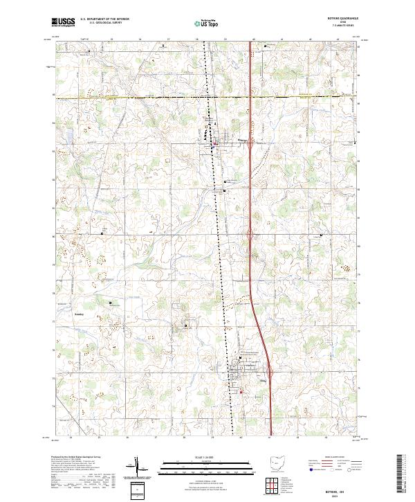
2023 Map of Botkins
USGS Topo · Published 2023About this map
The village of Botkins and the neighboring settlement of Anna anchor this portion of the Ohio landscape, situated along a primary north-south transportation corridor. The geography is defined by a dense network of watercourses, most notably Loramie Creek and its many tributaries, including Muddy Creek and Hulls Creek. These waterways and their associated drainage features, such as Keppler Ditch and Esty Ditch, reveal the systematic engineering of the local watershed to support the surrounding rural economy.
Find a feature on this map
78 named features on this map. Tap any name to fly to it.
Don’t see what you’re looking for? This feature index may not catch every label — zoom into the map to look around manually.
Map Details
Editions of this 2023 Botkins Map
This is the sole edition of this map. No revisions or reprints were ever made.
Other maps of this area

1906 · Lima
USGS Topo · 1:62,500

1909 · Loramie
USGS Topo · 1:62,500

1911 · Loramie
USGS Topo · 1:62,500

1911 · Spencerville
USGS Topo · 1:62,500

1913 · Sidney
USGS Topo · 1:62,500

1944 · Sidney
USGS Topo · 1:62,500

1944 · Loramie
USGS Topo · 1:62,500

1944 · Spencerville
USGS Topo · 1:62,500

1953 · Muncie
USGS Topo · 1:250,000

1956 · Muncie
USGS Topo · 1:250,000