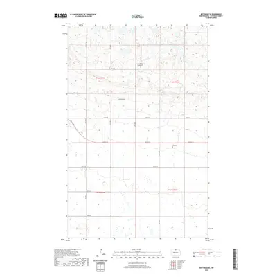
2020 Map of Bottineau SE
USGS Topo · Published 2020About this map
Turtle Mountains dominate the northern landscape of this Bottineau County quadrangle, where the terrain breaks into complex topographic contours. Below these elevations, the land transitions into the structured section lines of the Public Land Survey System, including the intersection of t162n r75w, t162n r74w, t161n r75w, and t161n r74w. A notable site for local history and genealogy is Tarus Cem, situated south of the mountain slopes. The hydrology is defined by numerous small wetlands and prairie potholes characteristic of the region, with Miller Cr winding through the southeastern corner. A strictly gridded road network, including 96th St NE and 100th St NE, facilitates movement through this rural agricultural landscape, while Glacier Ridge Dr follows the base of the prominent northern hills.
Find a feature on this map
16 named features on this map. Tap any name to fly to it.
Don’t see what you’re looking for? This feature index may not catch every label — zoom into the map to look around manually.
Map Details
Editions of this 2020 Bottineau SE Map
This is the sole edition of this map. No revisions or reprints were ever made.
Other maps of this area

1935 · Dunseith
USGS Topo · 1:48,000

1939 · Dunseith
USGS Topo · 1:62,500

1954 · Omemee
USGS Topo · 1:24,000

1954 · Gardena
USGS Topo · 1:24,000

1954 · Minot
USGS Topo · 1:250,000

1955 · Lords Lake
USGS Topo · 1:24,000

1955 · Overly
USGS Topo · 1:24,000

1955 · Bottineau
USGS Topo · 1:24,000

1955 · Bottineau SE
USGS Topo · 1:24,000

1956 · Metigoshe Lake
USGS Topo · 1:24,000