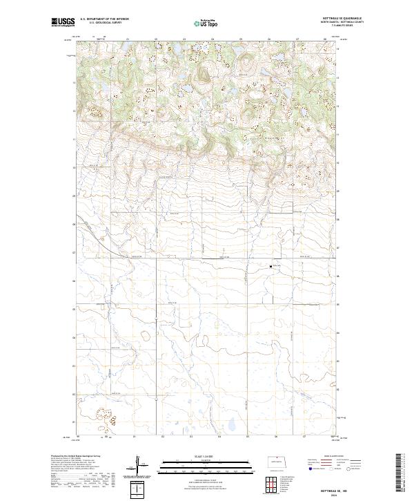
2024 Map of Bottineau SE
USGS Topo · Published 2024About this map
Turtle Mountains dominate the northern landscape of this North Dakota borderland, where the terrain transitions from upland forests to the expansive plains below. The map identifies the remote Tarus Cem situated near the center of the quadrangle, a significant point of interest for genealogists researching families from this corner of Bottineau County. To the south, the Bottineau County Waterfowl Production Area preserves the prairie pothole ecosystem, characterized by the numerous small water bodies and seasonal wetlands that define the regional hydrology. The land is organized by a precise grid of section lines and gravel roads, such as 96th St NE and 20th Ave NE, while Miller Creek meanders through the southeastern corner, illustrating the natural drainage patterns that have shaped local agriculture and conservation efforts.
Find a feature on this map
22 named features on this map. Tap any name to fly to it.
Don’t see what you’re looking for? This feature index may not catch every label — zoom into the map to look around manually.
Map Details
Editions of this 2024 Bottineau SE Map
This is the sole edition of this map. No revisions or reprints were ever made.
Other maps of this area

1935 · Dunseith
USGS Topo · 1:48,000

1939 · Dunseith
USGS Topo · 1:62,500

1954 · Omemee
USGS Topo · 1:24,000

1954 · Gardena
USGS Topo · 1:24,000

1954 · Minot
USGS Topo · 1:250,000

1955 · Lords Lake
USGS Topo · 1:24,000

1955 · Overly
USGS Topo · 1:24,000

1955 · Bottineau
USGS Topo · 1:24,000

1955 · Bottineau SE
USGS Topo · 1:24,000

1956 · Metigoshe Lake
USGS Topo · 1:24,000