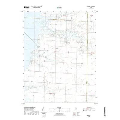
2018 Map of Boulder
USGS Topo · Published 2018About this map
The waters of Carlyle Lake dominate the northwestern landscape of this Illinois quadrangle, where the Kaskaskia River and its East Fork define the local drainage patterns. The settlement of Boulder sits at the intersection of Quick Rd and Co Hwy 3, serving as a central point for the surrounding agricultural community. This area is notably dense with small family and community burial grounds, which provide significant genealogical value for the region. These sites, including Pritchett Cem, Old Carter Cem, and Hawkins Cem, are scattered across the rural townships of t3n r1w and t4n r1w. The map also illustrates the confluence of several minor waterways such as Brewster Cr and Gibbs Cr, which weave between a grid of county roads like Wortman Rd and Brink Rd, reflecting the persistent rural structure of Clinton County and neighboring Fayette County.
Find a feature on this map
69 named features on this map. Tap any name to fly to it.
Don’t see what you’re looking for? This feature index may not catch every label — zoom into the map to look around manually.
Map Details
Editions of this 2018 Boulder Map
This is the sole edition of this map. No revisions or reprints were ever made.
Other maps of this area

1910 · Carlyle
USGS Topo · 1:62,500

1914 · Centralia
USGS Topo · 1:62,500

1932 · Greenville
USGS Topo · 1:62,500

1935 · Centralia
USGS Topo · 1:62,500

1939 · Greenville
USGS Topo · 1:62,500

1943 · Greenville
USGS Topo · 1:62,500

1945 · Vandalia
USGS Topo · 1:62,500

1947 · Vandalia
USGS Topo · 1:62,500

1948 · Carlyle
USGS Topo · 1:62,500

1958 · Belleville
USGS Topo · 1:250,000