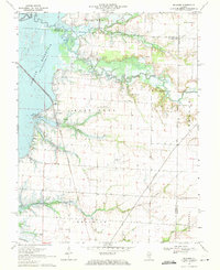
1969 Map of Boulder
USGS Topo · Published 1971About this map
The Carlyle Reservoir dominates the western edge of this 1969 landscape, where the inundated shoreline meets the older riverine systems of the Kaskaskia River. The town of Boulder serves as a central point for the local rail and road network, positioned along the Burlington Northern line. This survey captures a moment of industrial activity across the East Fork, marked by the Patoka Field and the Boulder East Oil Field, alongside the essential infrastructure of various pipelines.
Find a feature on this map
36 named features on this map. Tap any name to fly to it.
Don’t see what you’re looking for? This feature index may not catch every label — zoom into the map to look around manually.
Map Details
Editions of this 1969 Boulder Map
This is the sole edition of this map. No revisions or reprints were ever made.
Other maps of this area

1910 · Carlyle
USGS Topo · 1:62,500

1914 · Centralia
USGS Topo · 1:62,500

1932 · Greenville
USGS Topo · 1:62,500

1935 · Centralia
USGS Topo · 1:62,500

1939 · Greenville
USGS Topo · 1:62,500

1943 · Greenville
USGS Topo · 1:62,500

1945 · Vandalia
USGS Topo · 1:62,500

1947 · Vandalia
USGS Topo · 1:62,500

1948 · Carlyle
USGS Topo · 1:62,500

1958 · Belleville
USGS Topo · 1:250,000