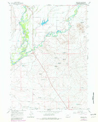
1964 Map of Boulder
USGS Topo · Published 1980About this map
New Fork River and the East Fork River dominate this Sublette County landscape, weaving through a valley shaped by irrigation and ranching history. The settlement of Boulder sits near the northern boundary, while the smaller junction at New Fork marks a historic crossing point. Water management is the primary human imprint on the terrain, evidenced by a dense network of canals including the Boulder Canal, Oliver Ditch, and Ball DITCH.
Find a feature on this map
37 named features on this map. Tap any name to fly to it.
Don’t see what you’re looking for? This feature index may not catch every label — zoom into the map to look around manually.
Map Details
Editions of this 1964 Boulder Map
2 editions found
Other maps of this area

1955 · Lander
USGS Topo · 1:250,000

1958 · Lander
USGS Topo · 1:250,000

1961 · Lander
USGS Topo · 1:250,000

1964 · Fremont Butte
USGS Topo · 1:24,000

1964 · Two Buttes Reservoir
USGS Topo · 1:24,000
1964 · Square Top
USGS Topo · 1:24,000

1964 · Boulder Lake
USGS Topo · 1:24,000
1964 · Olsen Ranch
USGS Topo · 1:24,000

1964 · Boulder
USGS Topo · 1:24,000
1964 · Pinedale
USGS Topo · 1:24,000