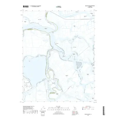
2018 Map of Bouldin Island
USGS Topo · Published 2018About this map
The San Joaquin River and its complex network of sloughs and cuts define this landscape where Sacramento County, San Joaquin County, and Contra Costa County meet. At the heart of the California Delta, large tract islands like Bouldin Island, Mandeville Island, and Venice Island are separated by intricate waterways including Potato Slough and Connection Slough. The presence of the Stockton Deep Water Channel cutting through Burns Reach and Three River Reach highlights the region's importance for maritime navigation.
Find a feature on this map
66 named features on this map. Tap any name to fly to it.
Don’t see what you’re looking for? This feature index may not catch every label — zoom into the map to look around manually.
Map Details
Editions of this 2018 Bouldin Island Map
This is the sole edition of this map. No revisions or reprints were ever made.
Other maps of this area

1894 · Lodi
USGS Topo · 1:125,000

1910 · New Hope
USGS Topo · 1:31,680

1910 · Rio Vista
USGS Topo · 1:31,680

1910 · Bouldin
USGS Topo · 1:31,680

1910 · Jersey
USGS Topo · 1:31,680

1910 · Headreach
USGS Topo · 1:31,680

1910 · Isleton
USGS Topo · 1:31,680

1913 · Woodward Island
USGS Topo · 1:31,680

1913 · Holt
USGS Topo · 1:31,680

1914 · Brentwood
USGS Topo · 1:31,680