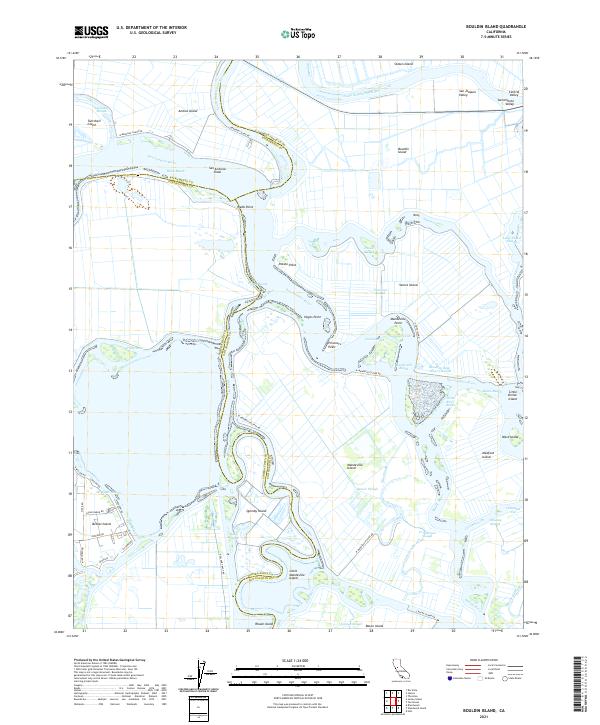
2021 Map of Bouldin Island
USGS Topo · Published 2021About this map
The interior waterways of the California Delta are preserved here in high detail, where the San Joaquin River and South Mokelumne River wind through a complex system of islands and sloughs. This particular area marks the intersection of Sacramento, San Joaquin, and Contra Costa counties, defined by its reclaimed agricultural tracts like Bouldin Island and Venice Island. The map illustrates the specialized infrastructure of the region, from the Stockton Deep Water Channel that facilitates maritime commerce to the levee roads such as W Mandeville Levee Rd that protect these low-lying lands.
Find a feature on this map
65 named features on this map. Tap any name to fly to it.
Don’t see what you’re looking for? This feature index may not catch every label — zoom into the map to look around manually.
Map Details
Editions of this 2021 Bouldin Island Map
This is the sole edition of this map. No revisions or reprints were ever made.
Other maps of this area

1894 · Lodi
USGS Topo · 1:125,000

1910 · New Hope
USGS Topo · 1:31,680

1910 · Rio Vista
USGS Topo · 1:31,680

1910 · Bouldin
USGS Topo · 1:31,680

1910 · Jersey
USGS Topo · 1:31,680

1910 · Headreach
USGS Topo · 1:31,680

1910 · Isleton
USGS Topo · 1:31,680

1913 · Woodward Island
USGS Topo · 1:31,680

1913 · Holt
USGS Topo · 1:31,680

1914 · Brentwood
USGS Topo · 1:31,680