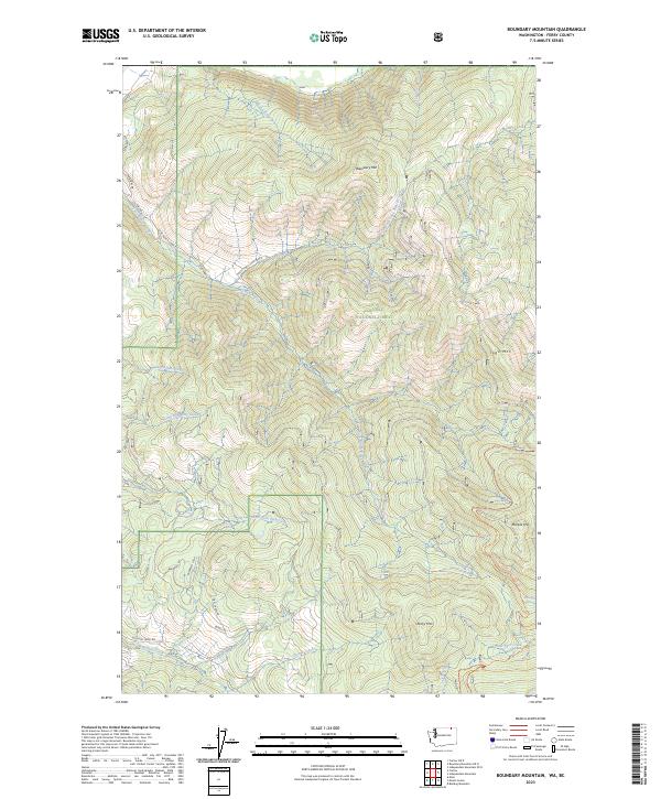
2023 Map of Boundary Mountain
USGS Topo · Published 2023About this map
Colville National Forest dominates this section of Ferry County, where the high ridges of the Kettle River Range meet the Canadian border. The terrain is defined by prominent summits including Boundary Mtn, Togo Mtn, Marble Mtn, and Rocky Mtn. A complex network of drainages such as Lone Ranch Creek and Skiffington Creek carve through the forested slopes, illustrating the remote and steep topography of the region. Transportation in this area is limited to a handful of forest and county roads, including Lone Ranch Rd and Boulder Creek Rd. Of particular interest to modern recreationists and researchers is the Pacific Northwest National Scenic Trl, which traverses the southern portion of the map near Noonday Spring. The land is divided by the Public Land Survey System, shown here across townships t40n r34e, t40n r35e, t39n r34e, and t39n r35e.
Find a feature on this map
34 named features on this map. Tap any name to fly to it.
Don’t see what you’re looking for? This feature index may not catch every label — zoom into the map to look around manually.
Map Details
Editions of this 2023 Boundary Mountain Map
This is the sole edition of this map. No revisions or reprints were ever made.
Other maps of this area

1904 · Republic
USGS Topo · 1:125,000

1936 · Marcus
USGS Topo · 1:96,000

1942 · Marcus
USGS Topo · 1:125,000

1948 · Curlew
USGS Topo · 1:62,500

1948 · Togo Mountain
USGS Topo · 1:62,500

1951 · Togo Mountain
USGS Topo · 1:62,500

1951 · Curlew
USGS Topo · 1:62,500

1954 · Okanogan
USGS Topo · 1:250,000

1958 · Okanogan
USGS Topo · 1:250,000
1983 · Bulldog Mtn
USGS Topo · 1:24,000