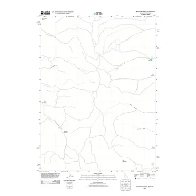
2011 Map of Boundary Ridge
USGS Topo · Published 2011About this map
Red Mountain anchors the southern landscape of this tri-state border region, where the high country of Wyoming meets Idaho and Utah. The drainage patterns are defined by a network of seasonal and perennial flows including Sweetwater Creek, Horse Creek, and Potato Creek, which carve out numerous hollows such as Dairy Hollow and Boyd Hollow. A single developed route, Nurenberg Ranch Rd, provides access into the interior, passing near Taylor Meadow and Red Rock Canyon.
Find a feature on this map
22 named features on this map. Tap any name to fly to it.
Don’t see what you’re looking for? This feature index may not catch every label — zoom into the map to look around manually.
Map Details
Editions of this 2011 Boundary Ridge Map
This is the sole edition of this map. No revisions or reprints were ever made.
Other maps of this area

1909 · Montpelier
USGS Topo · 1:125,000

1911 · Montpelier
USGS Topo · 1:125,000

1912 · Randolph
USGS Topo · 1:125,000

1936 · Cokeville
USGS Topo · 1:96,000

1942 · Cokeville
USGS Topo · 1:125,000

1954 · Sage
USGS Topo · 1:62,500

1954 · Ogden
USGS Topo · 1:250,000

1955 · Preston
USGS Topo · 1:250,000

1958 · Ogden
USGS Topo · 1:250,000

1958 · Preston
USGS Topo · 1:250,000