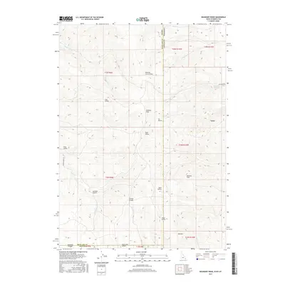
2017 Map of Boundary Ridge
USGS Topo · Published 2017About this map
Boundary Ridge serves as a critical geographic marker where the borders of Idaho, Wyoming, and Utah converge. This high-altitude terrain is defined by a series of deep drainage basins and canyons, including Red Rock Canyon and North Lake Canyon, which channel water into creeks like Pegram Creek and Christy Creek. The presence of Shearing Corral Hollow and Windmill Draw suggests a landscape historically utilized for livestock and ranching, supported by infrastructure like the Poison Creek Reservoir. Small settlements and ranching outposts like Taylor are connected by a sparse network of roads, including Humburg Ranch Rd and Dry Hollow Rd. The map illustrates the complex intersection of county and state lines, notably the divide between Bear Lake and Lincoln counties, as the land rises toward Red Mountain.
Find a feature on this map
36 named features on this map. Tap any name to fly to it.
Don’t see what you’re looking for? This feature index may not catch every label — zoom into the map to look around manually.
Map Details
Editions of this 2017 Boundary Ridge Map
This is the sole edition of this map. No revisions or reprints were ever made.
Other maps of this area

1909 · Montpelier
USGS Topo · 1:125,000

1911 · Montpelier
USGS Topo · 1:125,000

1912 · Randolph
USGS Topo · 1:125,000

1936 · Cokeville
USGS Topo · 1:96,000

1942 · Cokeville
USGS Topo · 1:125,000

1954 · Sage
USGS Topo · 1:62,500

1954 · Ogden
USGS Topo · 1:250,000

1955 · Preston
USGS Topo · 1:250,000

1958 · Ogden
USGS Topo · 1:250,000

1958 · Preston
USGS Topo · 1:250,000