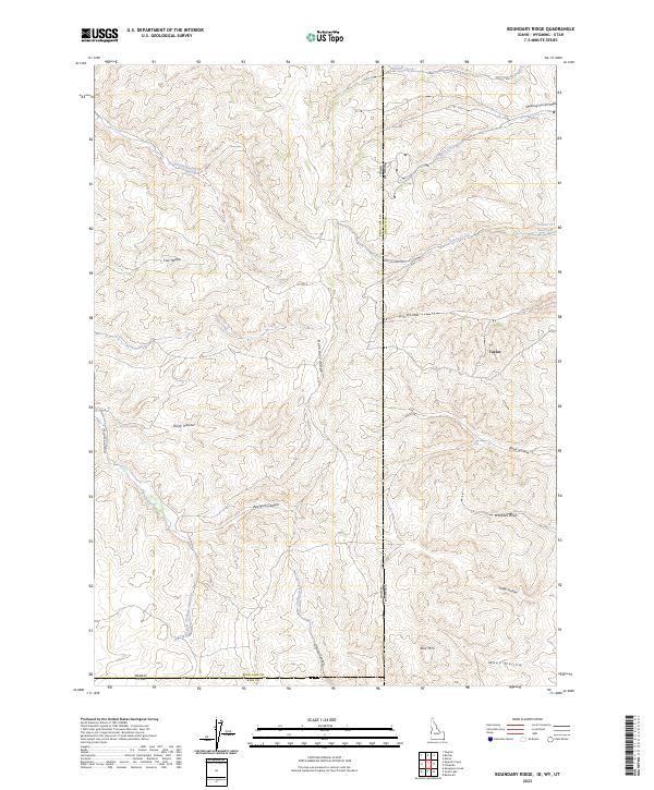
2023 Map of Boundary Ridge
USGS Topo · Published 2023About this map
Boundary Ridge defines the high-altitude topography of this tri-state corner, where the borders of Idaho, Wyoming, and Utah converge. The landscape is marked by a complex system of drainage and storage, including Poison Cr Reservoir and various seasonal flows like Sweetwater Creek and Pegram Creek. Settlement is sparse, represented by Taylor and localized ranching infrastructure accessible via Humburg Ranch Rd. The terrain is deeply incised by family-named canyons and draws, such as Christy Canyon, Red Rock Canyon, and Snow Hollow. This 2023 survey illustrates a high-desert environment where water management and cattle-grazing routes dictated the local nomenclature, from Windmill Draw to the winding Dry Hollow Rd.
Find a feature on this map
32 named features on this map. Tap any name to fly to it.
Don’t see what you’re looking for? This feature index may not catch every label — zoom into the map to look around manually.
Map Details
Editions of this 2023 Boundary Ridge Map
This is the sole edition of this map. No revisions or reprints were ever made.
Other maps of this area

1909 · Montpelier
USGS Topo · 1:125,000

1911 · Montpelier
USGS Topo · 1:125,000

1912 · Randolph
USGS Topo · 1:125,000

1936 · Cokeville
USGS Topo · 1:96,000

1942 · Cokeville
USGS Topo · 1:125,000

1954 · Sage
USGS Topo · 1:62,500

1954 · Ogden
USGS Topo · 1:250,000

1955 · Preston
USGS Topo · 1:250,000

1958 · Ogden
USGS Topo · 1:250,000

1958 · Preston
USGS Topo · 1:250,000