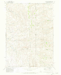
1970 Map of Boundary Ridge
USGS Topo · Published 1973About this map
Boundary Ridge forms the backbone of this high-elevation landscape, where the tri-state intersections of Idaho, Wyoming, and Utah converge across a complex network of drainages and plateaus. Surveyed in 1970, the map illustrates the remote ranching and grazing character of the Bear Lake Plateau, an area defined more by its water sources and named hollows than by permanent settlements. The presence of Dairy Hollow, Taylor Meadow, and various Spring locations suggests a landscape deeply tied to seasonal livestock movement and mountain resource extraction.
Find a feature on this map
30 named features on this map. Tap any name to fly to it.
Don’t see what you’re looking for? This feature index may not catch every label — zoom into the map to look around manually.
Map Details
Editions of this 1970 Boundary Ridge Map
This is the sole edition of this map. No revisions or reprints were ever made.
Other maps of this area

1909 · Montpelier
USGS Topo · 1:125,000

1911 · Montpelier
USGS Topo · 1:125,000

1912 · Randolph
USGS Topo · 1:125,000

1936 · Cokeville
USGS Topo · 1:96,000

1942 · Cokeville
USGS Topo · 1:125,000

1954 · Sage
USGS Topo · 1:62,500

1954 · Ogden
USGS Topo · 1:250,000

1955 · Preston
USGS Topo · 1:250,000

1958 · Ogden
USGS Topo · 1:250,000

1958 · Preston
USGS Topo · 1:250,000