
1919 Map of Boundary
USGS Topo · Published 1919About this map
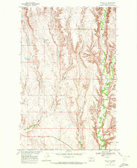
The International Boundary between the United States and Canada defines the northern edge of this northern Montana landscape, where drainage patterns dictate the placement of early ranching and agricultural outposts. Surveyed by the Corps of Engineers, U.S. Army under Col. Chas. L. Potter, the sheet captures the remote character of Valley County through isolated settlements like Morgan, Tango, and Tobison. The hydrology is dominated by north-south flowing watercourses including Rock Creek, Willow Creek, and Porcupine Creek, which carved the terrain long before modern infrastructure arrived. High points such as Rabbit and Cone provide the only significant elevation markers in an otherwise open prairie environment. This advance sheet serves as a primary source for understanding the early 20th-century distribution of rural centers like Wendell and Midway along these vital creek beds.
Find a feature on this map
30 named features on this map. Tap any name to fly to it.
Don’t see what you’re looking for? This feature index may not catch every label — zoom into the map to look around manually.
Map Details
Editions of this 1919 Boundary Map
This is the sole edition of this map. No revisions or reprints were ever made.
Other maps of this area

1906 · Hinsdale Special Map
USGS Topo · 1:62,500

1918 · Porcupine Valley
USGS Topo · 1:62,500

1943 · Glasgow
USGS Topo · 1:125,000

1954 · Glasgow
USGS Topo · 1:250,000

1957 · Glasgow
USGS Topo · 1:250,000

1958 · Glasgow
USGS Topo · 1:250,000

1969 · Cornwell Reservoir
USGS Topo · 1:24,000

1969 · Chapman Coulee NE
USGS Topo · 1:24,000
1969 · Tampico NE
USGS Topo · 1:24,000

1969 · Ellsworth Coulee
USGS Topo · 1:24,000