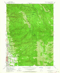
1952 Map of Bountiful Peak
USGS Topo · Published 1964About this map
Bountiful and Centerville sit at the western base of the Wasatch Range during a period of mid-century residential expansion. This 1952 field-checked survey highlights the interface between the growing valley settlements and the steep mountainous terrain of the Wasatch National Forest. Notable landmarks include the Bountiful High School and the small settlement of Stone, while the high country is defined by the winding route of Skyline Drive and the prominent Bountiful Peak.
Find a feature on this map
48 named features on this map. Tap any name to fly to it.
Don’t see what you’re looking for? This feature index may not catch every label — zoom into the map to look around manually.
Map Details
Editions of this 1952 Bountiful Peak Map
5 editions found
Other maps of this area

1885 · Salt Lake
USGS Topo · 1:250,000

1925 · Ft. Douglas
USGS Topo · 1:125,000

1928 · Ft. Douglas
USGS Topo · 1:125,000

1950 · Fort Douglas
USGS Topo · 1:24,000

1951 · Fort Douglas
USGS Topo · 1:24,000

1951 · Salt Lake City North
USGS Topo · 1:24,000

1952 · Farmington
USGS Topo · 1:24,000

1952 · Bountiful Peak
USGS Topo · 1:24,000

1954 · Salt Lake City
USGS Topo · 1:250,000

1954 · Ogden
USGS Topo · 1:250,000