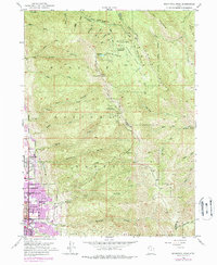
1952 Map of Bountiful Peak
USGS Topo · Published 1988About this map
The Wasatch Range dominates this mid-century survey, where the steep canyons of the Wasatch National Forest drop sharply toward the growing communities of the Salt Lake Valley. The 1950s footprint of Centerville and Bountiful City is visible along the base of the mountains, with purple revision layers from 1969 and 1975 showing the post-war suburban expansion. Landmarks such as Bountiful High School and the local Cem (cemetery) provide essential touchpoints for family historians.
Find a feature on this map
48 named features on this map. Tap any name to fly to it.
Don’t see what you’re looking for? This feature index may not catch every label — zoom into the map to look around manually.
Map Details
Editions of this 1952 Bountiful Peak Map
5 editions found
Other maps of this area

1885 · Salt Lake
USGS Topo · 1:250,000

1925 · Ft. Douglas
USGS Topo · 1:125,000

1928 · Ft. Douglas
USGS Topo · 1:125,000

1950 · Fort Douglas
USGS Topo · 1:24,000

1951 · Fort Douglas
USGS Topo · 1:24,000

1951 · Salt Lake City North
USGS Topo · 1:24,000

1952 · Farmington
USGS Topo · 1:24,000

1952 · Bountiful Peak
USGS Topo · 1:24,000

1954 · Salt Lake City
USGS Topo · 1:250,000

1954 · Ogden
USGS Topo · 1:250,000