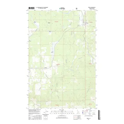
2017 Map of Bovill
USGS Topo · Published 2017About this map
Bovill and the smaller settlement of Helmer anchor this region of Latah County, where the local economy and geography are defined by the winding Potlatch River and its numerous tributaries. The landscape is characterized by a series of distinct openings in the timber, including Shea Meadows, Bronson Meadow, and Hog Meadow, which have historically served as vital landmarks for navigation and land use in this wooded part of Idaho.
Find a feature on this map
45 named features on this map. Tap any name to fly to it.
Don’t see what you’re looking for? This feature index may not catch every label — zoom into the map to look around manually.
Map Details
Editions of this 2017 Bovill Map
This is the sole edition of this map. No revisions or reprints were ever made.
Other maps of this area

1955 · Pullman
USGS Topo · 1:250,000

1958 · Pullman
USGS Topo · 1:250,000

1961 · Deary
USGS Topo · 1:62,500

1961 · Kendrick
USGS Topo · 1:62,500

1961 · Ahsahka
USGS Topo · 1:62,500

1961 · Bovill
USGS Topo · 1:62,500

1981 · Potlatch
USGS Topo · 1:100,000
1990 · Bechtel Butte
USGS Topo · 1:24,000
1990 · Mc Gary Butte
USGS Topo · 1:24,000
1990 · Texas Ridge
USGS Topo · 1:24,000