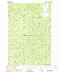
1990 Map of Bechtel Butte
USGS Topo · Published 1991About this map
Bechtel Butte stands as the primary landmark in this upland Idaho landscape where the borders of Latah, Shoshone, and Clearwater counties converge. The drainage patterns of the St Maries River and the E Fk Potlatch River define the local topography, carving paths through the timbered terrain. Notable for those interested in local land use, the map identifies a Race Track and a Gravel Pit, alongside named points such as Sherwin Point and the high meadow of Badger Meadows. Numerous tributary streams like Emerald Cr, Purdue Creek, and Bobs Creek illustrate a dense hydrographic network, while labels for Sherwin and Keeler indicate specific topographic or localized identification points in a region primarily shaped by its waterways and ridges.
Find a feature on this map
38 named features on this map. Tap any name to fly to it.
Don’t see what you’re looking for? This feature index may not catch every label — zoom into the map to look around manually.
Map Details
Editions of this 1990 Bechtel Butte Map
This is the sole edition of this map. No revisions or reprints were ever made.
Other maps of this area

1955 · Pullman
USGS Topo · 1:250,000

1955 · Spokane
USGS Topo · 1:250,000

1958 · Spokane
USGS Topo · 1:250,000

1958 · Pullman
USGS Topo · 1:250,000

1961 · Fernwood
USGS Topo · 1:62,500

1961 · Bovill
USGS Topo · 1:62,500

1969 · Elk River
USGS Topo · 1:24,000

1969 · Anthony Peak
USGS Topo · 1:24,000
1969 · Merry Creek
USGS Topo · 1:24,000

1981 · St Maries
USGS Topo · 1:100,000