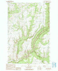
1990 Map of Texas Ridge
USGS Topo · Published 1991About this map
Texas Ridge and the surrounding plateaus of Latah County define this landscape at the turn of the 1990s. The terrain is deeply incised by the Potlatch River and its tributaries, including Big Bear Creek and Pine Creek, which have carved steep canyons between the high agricultural ridges. This map captures the social hubs of these rural uplands, where the Big Bear Ridge Community Hall and Gold Hill Community Hall served as central gathering points for the scattered farming community.
Find a feature on this map
17 named features on this map. Tap any name to fly to it.
Don’t see what you’re looking for? This feature index may not catch every label — zoom into the map to look around manually.
Map Details
Editions of this 1990 Texas Ridge Map
This is the sole edition of this map. No revisions or reprints were ever made.
Other maps of this area

1955 · Pullman
USGS Topo · 1:250,000

1958 · Pullman
USGS Topo · 1:250,000

1961 · Deary
USGS Topo · 1:62,500

1961 · Kendrick
USGS Topo · 1:62,500

1961 · Ahsahka
USGS Topo · 1:62,500

1961 · Bovill
USGS Topo · 1:62,500

1981 · Potlatch
USGS Topo · 1:100,000
1990 · Juliaetta
USGS Topo · 1:24,000
1990 · Stanford
USGS Topo · 1:24,000
1990 · Lenore
USGS Topo · 1:24,000