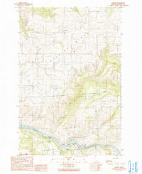
1990 Map of Lenore
USGS Topo · Published 1991About this map
The Clearwater River winds through the southern portion of this landscape, defining the local geography and supporting the small riverside communities of Lenore, Agatha, and Wifola. Along the riverbanks, infrastructure like Grain Elevators, a Boat Ramp, and a Post Office in Lenore point to a settlement pattern centered on the water and regional transport. Further north, the plateau is marked by more isolated agricultural settlements like Cameron and Leland, the latter situated near the headwaters of Pine Creek.
Find a feature on this map
30 named features on this map. Tap any name to fly to it.
Don’t see what you’re looking for? This feature index may not catch every label — zoom into the map to look around manually.
Map Details
Editions of this 1990 Lenore Map
This is the sole edition of this map. No revisions or reprints were ever made.
Other maps of this area

1924 · Kamiah
USGS Topo · 1:125,000

1955 · Pullman
USGS Topo · 1:250,000

1958 · Pullman
USGS Topo · 1:250,000

1958 · Culdesac
USGS Topo · 1:62,500

1961 · Kendrick
USGS Topo · 1:62,500

1961 · Ahsahka
USGS Topo · 1:62,500

1967 · Peck
USGS Topo · 1:24,000

1981 · Orofino
USGS Topo · 1:100,000

1981 · Potlatch
USGS Topo · 1:100,000
1984 · Culdesac North
USGS Topo · 1:24,000