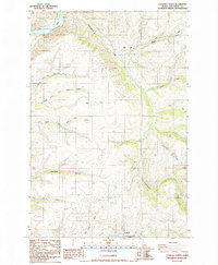
1984 Map of Culdesac North
USGS Topo · Published 1985About this map
Culdesac sits at the southern edge of this mid-1980s topographical study, marking a transition point between the higher plateaus and the canyon floor. The landscape is defined by the dramatic descent of watercourses toward the Clearwater River in the northwest, including the complex drainage systems of Cottonwood Creek and the various forks of Tom Beall Creek. These deep incisions into the Camas Prairie uplands reflect a classic Idaho river-canyon geography, where road infrastructure like the Kettenbach Grade was necessary to navigate the steep elevation changes.
Find a feature on this map
20 named features on this map. Tap any name to fly to it.
Don’t see what you’re looking for? This feature index may not catch every label — zoom into the map to look around manually.
Map Details
Editions of this 1984 Culdesac North Map
This is the sole edition of this map. No revisions or reprints were ever made.
Other maps of this area

1955 · Pullman
USGS Topo · 1:250,000

1958 · Pullman
USGS Topo · 1:250,000

1958 · Lapwai
USGS Topo · 1:24,000

1958 · Sweetwater
USGS Topo · 1:24,000

1958 · Lewiston Orchards
USGS Topo · 1:62,500

1958 · Culdesac
USGS Topo · 1:62,500

1961 · Kendrick
USGS Topo · 1:62,500

1961 · Moscow
USGS Topo · 1:62,500

1981 · Orofino
USGS Topo · 1:100,000

1981 · Potlatch
USGS Topo · 1:100,000