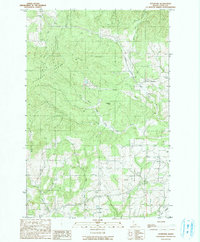
1990 Map of Stanford
USGS Topo · Published 1990About this map
Stanford sits at the nexus of a complex drainage system within Latah County, where the southern slopes of the Palouse Range meet a series of prominent ridges and valleys. The landscape is defined by its industrial extractive sites and the intricate network of the Bear Creek system, including the Middle Fork and West Fork. To the south, Little Bear Ridge and the Bergs Creek Valley dominate the topography, illustrating the transition from the high points of Stanford Point to the lower creek bottoms.
Find a feature on this map
21 named features on this map. Tap any name to fly to it.
Don’t see what you’re looking for? This feature index may not catch every label — zoom into the map to look around manually.
Map Details
Editions of this 1990 Stanford Map
This is the sole edition of this map. No revisions or reprints were ever made.
Other maps of this area

1955 · Pullman
USGS Topo · 1:250,000

1958 · Pullman
USGS Topo · 1:250,000

1960 · Troy
USGS Topo · 1:24,000

1960 · Moscow Mtn
USGS Topo · 1:24,000

1960 · Potlatch
USGS Topo · 1:62,500

1961 · Deary
USGS Topo · 1:62,500

1961 · Kendrick
USGS Topo · 1:62,500

1961 · Moscow
USGS Topo · 1:62,500

1981 · Potlatch
USGS Topo · 1:100,000
1990 · Harvard
USGS Topo · 1:24,000