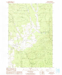
1990 Map of Harvard
USGS Topo · Published 1990About this map
Harvard sits along the banks of the Palouse River in this 1990 survey of the Idaho panhandle, illustrating a landscape defined by timber, recreation, and mineral extraction. The small settlement is surrounded by the vast St Joe National Forest, where the topography rises sharply toward Flynn Butte and Strychnine Ridge. Notable for local history and genealogy, the map identifies the Woodfell Cem nestled along Cow Creek and the legacy of mining in the area via the Gold Hill Mine and Gold Bug Mine near Jerome Creek. Recreational life is evident at Laird Park Campground and Camp Grizzly, while the natural hydrology is traced through numerous drainages including Strychnine Creek, Quartz Creek, and Ruby Creek. The map provides a precise look at the transition from river valley to high ridge before the modern era, showing the infrastructure of the day from a Gaging Station to a Windmill and a Quarry.
Find a feature on this map
44 named features on this map. Tap any name to fly to it.
Don’t see what you’re looking for? This feature index may not catch every label — zoom into the map to look around manually.
Map Details
Editions of this 1990 Harvard Map
This is the sole edition of this map. No revisions or reprints were ever made.
Other maps of this area

1955 · Pullman
USGS Topo · 1:250,000

1955 · Spokane
USGS Topo · 1:250,000

1957 · Emida
USGS Topo · 1:62,500

1957 · Tensed
USGS Topo · 1:62,500

1958 · Spokane
USGS Topo · 1:250,000

1958 · Pullman
USGS Topo · 1:250,000

1960 · Moscow Mtn
USGS Topo · 1:24,000

1960 · Potlatch
USGS Topo · 1:62,500

1961 · Deary
USGS Topo · 1:62,500

1981 · St Maries
USGS Topo · 1:100,000