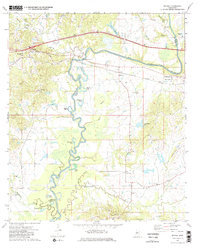
1972 Map of Bovina
USGS Topo · Published 1982About this map
The Big Black River carves a winding path through the borderlands of Warren and Hinds counties, creating a complex landscape of oxbows and bottomlands including Horseshoe Lake, Gin Lake, and Tomcat Island. In the early 1970s, the rural community of Bovina sat along the path of Interstate 20, while the Illinois Central Gulf Railroad tracked the river valley through Smiths. The map records several localized centers of community life, most notably the site of Mt Beulah College (Abandoned) and numerous country churches such as Morning Star Ch and Pleasant Grove Ch. This period shows a transition in the local economy, where traditional river-and-rail proximity intersects with modern interstate transport, though the landscape remains dotted with family cemeteries like Henry Cem and Montgomery Cem that speak to deeper ancestral roots in the Mississippi hill country.
Find a feature on this map
49 named features on this map. Tap any name to fly to it.
Don’t see what you’re looking for? This feature index may not catch every label — zoom into the map to look around manually.
Map Details
Editions of this 1972 Bovina Map
3 editions found
Other maps of this area

1918 · Vicksburg
USGS Topo · 1:62,500

1938 · Edwards
USGS Topo · 1:62,500

1939 · Yokena
USGS Topo · 1:62,500

1941 · Vicksburg
USGS Topo · 1:62,500

1955 · Jackson
USGS Topo · 1:250,000

1961 · Jackson
USGS Topo · 1:250,000

1962 · Jackson
USGS Topo · 1:250,000

1962 · Redwood
USGS Topo · 1:24,000

1962 · Vicksburg East
USGS Topo · 1:24,000
1963 · Learned
USGS Topo · 1:24,000