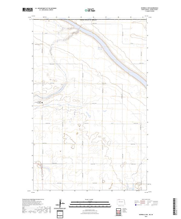
2024 Map of Bowbells NW
USGS Topo · Published 2024About this map
Upper Des Lacs Lake and its surrounding wetlands dominate this landscape in Burke County, where the valley floor sits nearly two hundred feet below the surrounding North Dakota prairie. The Des Lacs National Wildlife Refuge encompasses the waterway and its marshy margins, preserving a critical corridor for migratory waterfowl. On the higher ground to the west, the rural character of the area is anchored by the Saint Pauls Evangelical Lutheran Church and the adjacent Saint Pauls Evangelical Lutheran Church Cem. The land is divided into a strict grid by gravel roads such as 106th St NW and 68th Ave NW, which cross the undulating plains and seasonal drainages like Stony Creek. This map reflects the enduring agricultural and conservation-focused layout of the region, where section lines dictate the movement of people and the protection of local ecosystems.
Find a feature on this map
29 named features on this map. Tap any name to fly to it.
Don’t see what you’re looking for? This feature index may not catch every label — zoom into the map to look around manually.
Map Details
Editions of this 2024 Bowbells NW Map
This is the sole edition of this map. No revisions or reprints were ever made.
Other maps of this area

1947 · Bowbells NW
USGS Topo · 1:24,000

1947 · Bowbells
USGS Topo · 1:24,000

1948 · Coteau
USGS Topo · 1:24,000

1949 · Bowbells
USGS Topo · 1:24,000

1949 · Bowbells SE
USGS Topo · 1:24,000

1949 · Bowbells NW
USGS Topo · 1:24,000

1949 · Bowbells NE
USGS Topo · 1:24,000
1949 · Northgate
USGS Topo · 1:24,000

1950 · Bowbells
USGS Topo · 1:62,500

1950 · Flaxton
USGS Topo · 1:62,500