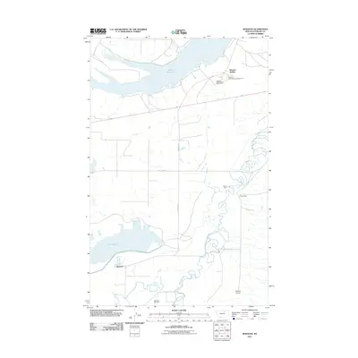
2011 Map of Bowdoin
USGS Topo · Published 2011About this map
Nelson Reservoir dominates the northern landscape of this Phillips County region, serving as a primary water source in an area defined by its irrigation and ranching networks. The settlement of Sleeping Buffalo sits near the reservoir's eastern edge, accompanied by the Sleeping Buffalo Resort Golf Course and campground, illustrating the area's development into a recreational destination. Further south, the map reveals the small community of Bowdoin and the nearby Bowdoin Cemetery, which provide critical points of interest for genealogists tracking early twentieth-century residents.
Find a feature on this map
13 named features on this map. Tap any name to fly to it.
Don’t see what you’re looking for? This feature index may not catch every label — zoom into the map to look around manually.
Map Details
Editions of this 2011 Bowdoin Map
This is the sole edition of this map. No revisions or reprints were ever made.
Other maps of this area

1905 · Bowdoin
USGS Topo · 1:62,500

1905 · Saco Special
USGS Topo · 1:62,500

1920 · Cowan
USGS Topo · 1:125,000

1954 · Glasgow
USGS Topo · 1:250,000

1957 · Glasgow
USGS Topo · 1:250,000

1958 · Glasgow
USGS Topo · 1:250,000
1968 · Hewitt Lake
USGS Topo · 1:24,000

1968 · Hewitt Lake SW
USGS Topo · 1:24,000

1984 · Clanton Coulee
USGS Topo · 1:24,000

1984 · Cole
USGS Topo · 1:24,000