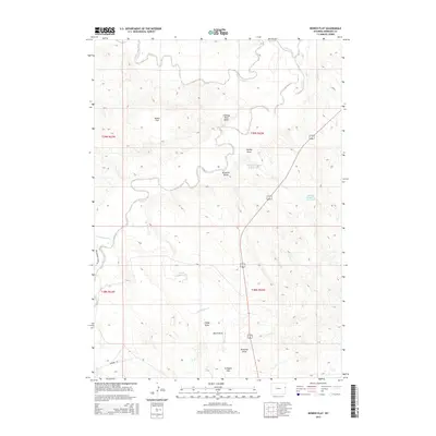
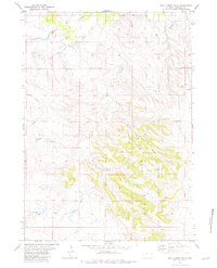
2015 Map of Bowen Flat
USGS Topo · Published 2015About this map
The Cheyenne River carves a winding path through the northern reaches of this Niobrara County landscape, setting a contrast to the high, arid plains of the surrounding region. The terrain is defined by a network of seasonal watercourses and topographic landmarks like Chimney Rock Butte and the namesake Bowen Flat. This modern survey illustrates the persistent ranching and water-management patterns of eastern Wyoming, highlighted by the Rumney Number 2 Reservoir and Rumney Number 3 Reservoir. Local transit and land access are anchored by Greasewood Ridge Rd and Redbird Rd, which navigate around a complex series of drainages including Old Woman Cr and Lance Cr. The map provides a clear look at the public land survey system divisions across Culligans Flats, marking the enduring boundaries of the American West.
Find a feature on this map
23 named features on this map. Tap any name to fly to it.
Don’t see what you’re looking for? This feature index may not catch every label — zoom into the map to look around manually.
Map Details
Editions of this 2015 Bowen Flat Map
This is the sole edition of this map. No revisions or reprints were ever made.
Other maps of this area

1955 · Newcastle
USGS Topo · 1:250,000

1958 · Newcastle
USGS Topo · 1:250,000
1978 · Riverview
USGS Topo · 1:24,000
1978 · Mule Creek
USGS Topo · 1:24,000
1978 · Oat Creek NW
USGS Topo · 1:24,000
1981 · Threemile Butte
USGS Topo · 1:24,000
1981 · Little Alkali Creek
USGS Topo · 1:24,000
1981 · Redbird
USGS Topo · 1:24,000
1981 · Bowen Flat
USGS Topo · 1:24,000
1981 · Buck Creek Hills
USGS Topo · 1:24,000