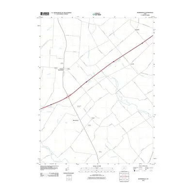
2010 Map of Bowersville
USGS Topo · Published 2010About this map
Bowersville and the surrounding agricultural landscape of Clinton County are defined by a geometric grid of rural roads and the drainage of the West Branch Rattlesnake Creek. This 2010 survey illustrates a region where small settlements like Bloomington, Luttrell, and Edgefield serve as nodes in a widespread farming community. The map is particularly notable for its density of burial grounds, including the Hussey Cemetery, Woodlawn Cemetery, and Stewart Cemetery located near the town center, as well as the more remote Thorpe Cemetery and Coulter Cemetery to the south. These sites, along with the Bowersville Post Office, provide essential touchstones for genealogical research. The terrain is relatively level, with subtle relief indicated by the paths of Grassy Run and Wilson Creek as they meander toward the Anderson Fork.
Find a feature on this map
66 named features on this map. Tap any name to fly to it.
Don’t see what you’re looking for? This feature index may not catch every label — zoom into the map to look around manually.
Map Details
Editions of this 2010 Bowersville Map
This is the sole edition of this map. No revisions or reprints were ever made.
Other maps of this area

1907 · Blanchester
USGS Topo · 1:62,500

1916 · Octa
USGS Topo · 1:62,500

1917 · Xenia
USGS Topo · 1:62,500

1917 · Sabina
USGS Topo · 1:62,500

1943 · Sabina
USGS Topo · 1:62,500

1944 · Octa
USGS Topo · 1:62,500

1947 · Columbus
USGS Topo · 1:250,000

1955 · Cedarville
USGS Topo · 1:24,000

1955 · Port William
USGS Topo · 1:24,000

1961 · Columbus
USGS Topo · 1:250,000