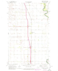
1971 Map of Bowesmont
USGS Topo · Published 1980About this map
The Red River forms a winding border between North Dakota and Minnesota, defining the eastern edge of this agricultural landscape in Pembina County. By the early 1970s, the region's transport network was undergoing modernization, most notably with the construction of Interstate 29 and its major access points at Bowesmont Interchange and Lincoln Interchange. This highway runs parallel to the older Burlington Northern railroad line, which served the small settlements of Bowesmont and Pittsburg. The map reveals an intricate system of water management, with numerous drainage projects such as County Ditch No 6 and County Ditch No 27 cutting across the townships of Joliette and Lincoln. This network reflects the transition of the Red River Valley into a highly engineered fertile plain, where a lone Radio Tower and buried Pipeline represent the late-century infrastructure of the rural prairie.
Find a feature on this map
22 named features on this map. Tap any name to fly to it.
Don’t see what you’re looking for? This feature index may not catch every label — zoom into the map to look around manually.
Map Details
Editions of this 1971 Bowesmont Map
2 editions found
Other maps of this area

1939 · Drayton
USGS Topo · 1:62,500

1939 · Glasston
USGS Topo · 1:62,500

1939 · Pembina
USGS Topo · 1:62,500

1941 · Drayton
USGS Topo · 1:62,500

1941 · Glasston
USGS Topo · 1:62,500

1941 · Bathgate
USGS Topo · 1:62,500

1941 · Pembina
USGS Topo · 1:62,500

1952 · Thief River Falls
USGS Topo · 1:250,000

1956 · Thief River Falls
USGS Topo · 1:250,000

1957 · Thief River Falls
USGS Topo · 1:250,000