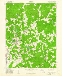
1949 Map of Bowling Green
USGS Topo · Published 1961About this map
Bowling Green serves as the focal point for this mid-century survey of Caroline County, depicting a landscape split between civilian commerce and military expansion. The northern half of the sheet is dominated by the A P Hill Military Reservation, which subsumed several local landmarks and crossroads. Within the reservation boundary, sites such as Baylortown, Ann Webster Corner, and Acois Corner reflect the area's rural history prior to military acquisition.
Find a feature on this map
47 named features on this map. Tap any name to fly to it.
Don’t see what you’re looking for? This feature index may not catch every label — zoom into the map to look around manually.
Map Details
Editions of this 1949 Bowling Green Map
2 editions found
Other maps of this area

1889 · Fredericksburg
USGS Topo · 1:125,000

1892 · Fredericksburg
USGS Topo · 1:125,000

1894 · Fredericksburg
USGS Topo · 1:125,000

1918 · Doswell
USGS Topo · 1:62,500

1918 · Aylett
USGS Topo · 1:62,500

1933 · Aylett
USGS Topo · 1:62,500

1942 · Bowling Green
USGS Topo · 1:31,680

1942 · Upper Zion
USGS Topo · 1:31,680

1942 · Woodford
USGS Topo · 1:31,680

1942 · Guinea
USGS Topo · 1:31,680