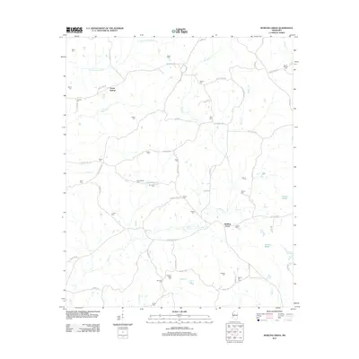
2012 Map of Bowling Green
USGS Topo · Published 2012About this map
Bowling Green and Poplar Springs anchor this rural Mississippi landscape, which is defined by an extensive network of family cemeteries and winding waterways. The map reveal a deeply rooted community structure, where small burial grounds like Jenkins Cem, Rogers Cem, and Thurmond Cem are tucked away along county routes like Stokes Cemetery Rd and Hopewell Rd. The drainage pattern is complex, with Black Creek and Beaver Creek meandering through the territory alongside Bisland Bayou. This topography is largely shaped by the interplay of these creeks and the low-lying bayou areas, creating a patchwork of accessible ridges and wetlands. The prevalence of named cemeteries and legacy roads like Smith-Bailey Rd offers significant detail for genealogists tracing ancestral land tracts in Holmes County.
Find a feature on this map
74 named features on this map. Tap any name to fly to it.
Don’t see what you’re looking for? This feature index may not catch every label — zoom into the map to look around manually.
Map Details
Editions of this 2012 Bowling Green Map
This is the sole edition of this map. No revisions or reprints were ever made.
Other maps of this area

1940 · Seven Pines
USGS Topo · 1:62,500

1940 · Lexington
USGS Topo · 1:62,500

1953 · Greenwood
USGS Topo · 1:250,000

1953 · West Point
USGS Topo · 1:250,000

1956 · Greenwood
USGS Topo · 1:250,000

1957 · Lexington
USGS Topo · 1:62,500

1957 · Seven Pines
USGS Topo · 1:62,500

1958 · West Point
USGS Topo · 1:250,000

1958 · Seven Pines
USGS Topo · 1:62,500

1958 · Lexington
USGS Topo · 1:62,500