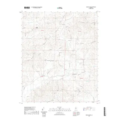
2020 Map of Bowling Green
USGS Topo · Published 2020About this map
Bowling Green and the nearby settlement of Poplar Springs anchor this portion of Holmes County, where the landscape is defined by an intricate network of creeks and bayous. The area's history is written in its numerous family and community burial grounds, including the Pleasant Ridge Cem, Bethesda Cem, and the Hooker Cem. These sites, often situated near winding roads like Beulah Grove Rd and Montgomery Rd, reflect generations of local residency and land use. The topography is shaped by the drainage patterns of Black Cr and Little Fannegusha Cr, while to the east, Bisland Bayou winds through the lower elevations. The prevalence of named cemeteries such as Saffold Cem and Jenkins Cem suggests a deeply rooted rural community structure, where small settlements and family plots were interconnected by a complex web of local routes like Bowling Green Rd.
Find a feature on this map
75 named features on this map. Tap any name to fly to it.
Don’t see what you’re looking for? This feature index may not catch every label — zoom into the map to look around manually.
Map Details
Editions of this 2020 Bowling Green Map
This is the sole edition of this map. No revisions or reprints were ever made.
Other maps of this area

1940 · Seven Pines
USGS Topo · 1:62,500

1940 · Lexington
USGS Topo · 1:62,500

1953 · Greenwood
USGS Topo · 1:250,000

1953 · West Point
USGS Topo · 1:250,000

1956 · Greenwood
USGS Topo · 1:250,000

1957 · Lexington
USGS Topo · 1:62,500

1957 · Seven Pines
USGS Topo · 1:62,500

1958 · West Point
USGS Topo · 1:250,000

1958 · Seven Pines
USGS Topo · 1:62,500

1958 · Lexington
USGS Topo · 1:62,500