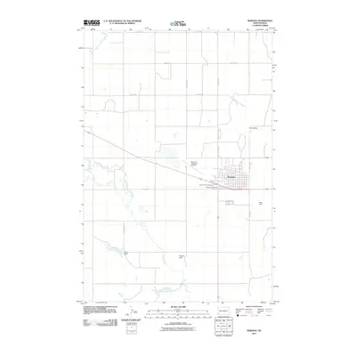
2011 Map of Bowman
USGS Topo · Published 2011About this map
Bowman serves as the central hub of this southwestern North Dakota landscape, organized by a precise grid of rural roads and regional connectors like Old Hwy 12. The town's layout is flanked by significant local landmarks, including the Bowman Municipal Airport and Miller Field, while the spiritual and genealogical history of the community is anchored at Saint Charles Cemetery and Bowman Cemetery just south of the main residential area.
Find a feature on this map
20 named features on this map. Tap any name to fly to it.
Don’t see what you’re looking for? This feature index may not catch every label — zoom into the map to look around manually.
Map Details
Editions of this 2011 Bowman Map
This is the sole edition of this map. No revisions or reprints were ever made.
Other maps of this area

1953 · Dickinson
USGS Topo · 1:250,000

1957 · Dickinson
USGS Topo · 1:250,000

1968 · Bowman SW
USGS Topo · 1:24,000

1968 · Bowman
USGS Topo · 1:24,000

1973 · Talbot Butte
USGS Topo · 1:24,000

1973 · Amidon SE
USGS Topo · 1:24,000
1973 · Rhame SE
USGS Topo · 1:24,000
1973 · Bowman SE
USGS Topo · 1:24,000

1973 · Stewart Lake
USGS Topo · 1:24,000

1973 · Griffin
USGS Topo · 1:24,000