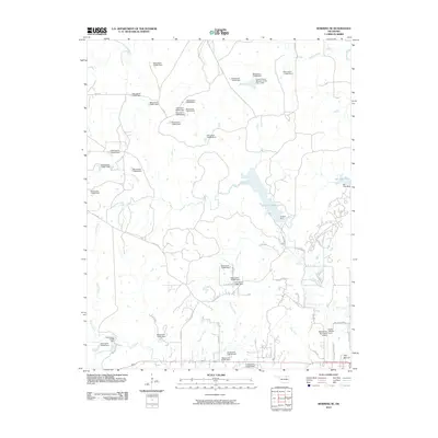
2010 Map of Bowring SE
USGS Topo · Published 2010About this map
The Bartlesville Municipal Airport, also identified here as Frank Phillips Field, anchor the southeastern corner of this landscape, marking the northern outskirts of Bartlesville. The terrain is defined by a dense network of small tributaries and numerous water management structures, including a series of numbered dams. Central to the area is the significant expanse of Lake Hudson, held by the Hudson Dam, which serves as a major hydrological feature for the region. To the northeast, the Caney River flows through the territory, joined by local waterways such as Mission Creek and Butler Creek. The map shows a transition from the structured aviation infrastructure of the south to a more dispersed rural layout characterized by county roads like Co RD 3551 and distinctive landmarks such as The Mound. Smaller reservoirs like Bar-Dew Lake further illustrate the managed water systems in this part of Oklahoma.
Find a feature on this map
55 named features on this map. Tap any name to fly to it.
Don’t see what you’re looking for? This feature index may not catch every label — zoom into the map to look around manually.
Map Details
Editions of this 2010 Bowring SE Map
This is the sole edition of this map. No revisions or reprints were ever made.
Other maps of this area

1901 · Nowata
USGS Topo · 1:125,000

1906 · Nelagoney
USGS Topo · 1:24,000

1909 · Pawhuska
USGS Topo · 1:125,000

1910 · Pawhuska
USGS Topo · 1:125,000

1914 · Nowata
USGS Topo · 1:125,000

1954 · Tulsa
USGS Topo · 1:250,000

1955 · Enid
USGS Topo · 1:250,000

1958 · Enid
USGS Topo · 1:250,000

1958 · Tulsa
USGS Topo · 1:250,000

1960 · Nelagoney
USGS Topo · 1:24,000