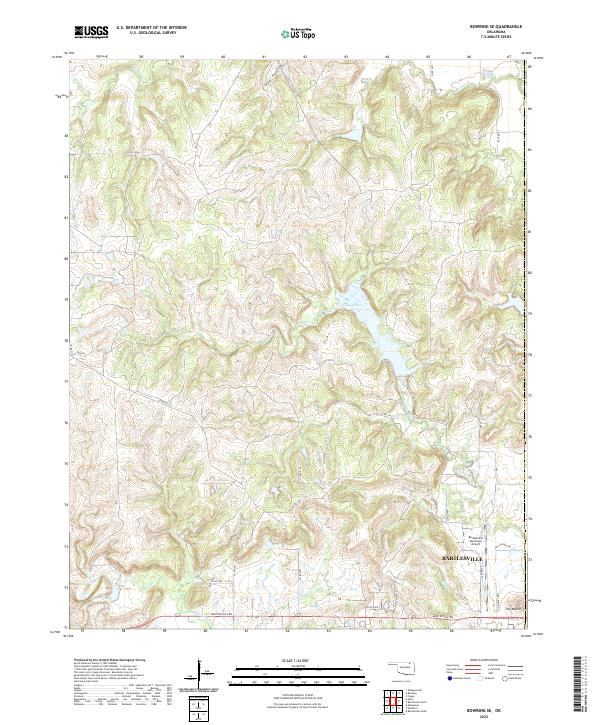
2022 Map of Bowring SE
USGS Topo · Published 2022About this map
Bartlesville occupies the southeastern corner of this landscape, where the urban edge meets the rolling drainage basins of Osage County. The northeastern reaches of the city are defined by the Bartlesville Municipal Airport and residential developments along Will Rogers Dr and Wiley Post Rd. To the west, the terrain transitions into a dense network of watercourses including Butler Cr, which feeds into the central Lake Hudson, and the winding Caney River that cuts across the northeastern quadrant. Significant elevation changes are marked by The Mound in the southeast, while the rural interior is accessed via a grid of county roads such as Co Rd 3350 and Bartlesville Rd. This survey details the intersection of municipal infrastructure and the natural hydrological system of the Buck Creek and Mission Cr valleys.
Find a feature on this map
41 named features on this map. Tap any name to fly to it.
Don’t see what you’re looking for? This feature index may not catch every label — zoom into the map to look around manually.
Map Details
Editions of this 2022 Bowring SE Map
This is the sole edition of this map. No revisions or reprints were ever made.
Other maps of this area

1901 · Nowata
USGS Topo · 1:125,000

1906 · Nelagoney
USGS Topo · 1:24,000

1909 · Pawhuska
USGS Topo · 1:125,000

1910 · Pawhuska
USGS Topo · 1:125,000

1914 · Nowata
USGS Topo · 1:125,000

1954 · Tulsa
USGS Topo · 1:250,000

1955 · Enid
USGS Topo · 1:250,000

1958 · Enid
USGS Topo · 1:250,000

1958 · Tulsa
USGS Topo · 1:250,000

1960 · Nelagoney
USGS Topo · 1:24,000