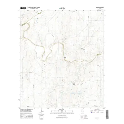
2016 Map of Bowser
USGS Topo · Published 2016About this map
The Colorado River carves a sinuous path through this rural landscape where the borders of San Saba, Mills, and Brown counties converge. Small settlements and local landmarks dot the terrain, including the community of Bowser and the nearby Locker. Genealogists and local historians will find significant value in the distribution of family and community burial grounds across the area, such as Bowser Cem, Locker Cem, Ebony Cem, and Vargy Chapel Cem. These sites, often situated near watercourses like Wilbarger Cr and Gregory Cr, mark the enduring footprints of early ranching and farming families in this corner of Central Texas.
Find a feature on this map
63 named features on this map. Tap any name to fly to it.
Don’t see what you’re looking for? This feature index may not catch every label — zoom into the map to look around manually.
Map Details
Editions of this 2016 Bowser Map
This is the sole edition of this map. No revisions or reprints were ever made.
Other maps of this area

1885 · San Saba
USGS Topo · 1:125,000

1887 · Coleman
USGS Topo · 1:125,000

1889 · Brownwood
USGS Topo · 1:125,000

1889 · Coleman
USGS Topo · 1:125,000

1894 · Brady
USGS Topo · 1:125,000

1894 · Brownwood
USGS Topo · 1:125,000

1894 · San Saba
USGS Topo · 1:125,000

1925 · San Saba 2-a
USGS Topo · 1:48,000

1925 · Brady 1-a
USGS Topo · 1:48,000

1925 · Brownwood 3-d
USGS Topo · 1:48,000