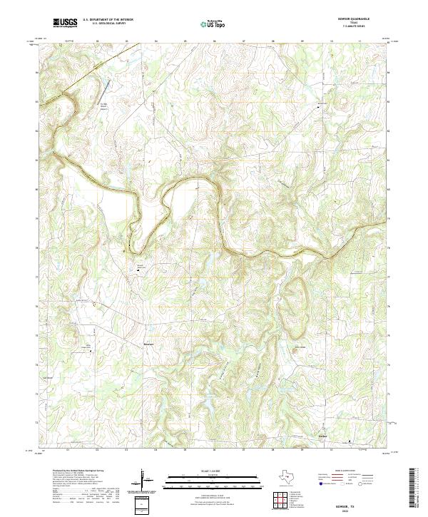
2022 Map of Bowser
USGS Topo · Published 2022About this map
The Colorado River carves a deep, winding path through the heart of this Central Texas landscape, marking the historic boundary between Mills and San Saba counties. This contemporary survey documents the rural character of the region, where small settlements like Bowser and Locker anchor a network of ranch roads and limestone-rich terrain. The area is defined by its distinct topography, featuring prominent landmarks such as Corn Knob and Cat Knob, alongside deep drainages like Laird Hollow and Harky Hollow.
Find a feature on this map
65 named features on this map. Tap any name to fly to it.
Don’t see what you’re looking for? This feature index may not catch every label — zoom into the map to look around manually.
Map Details
Editions of this 2022 Bowser Map
This is the sole edition of this map. No revisions or reprints were ever made.
Other maps of this area

1885 · San Saba
USGS Topo · 1:125,000

1887 · Coleman
USGS Topo · 1:125,000

1889 · Brownwood
USGS Topo · 1:125,000

1889 · Coleman
USGS Topo · 1:125,000

1894 · Brady
USGS Topo · 1:125,000

1894 · Brownwood
USGS Topo · 1:125,000

1894 · San Saba
USGS Topo · 1:125,000

1925 · San Saba 2-a
USGS Topo · 1:48,000

1925 · Brady 1-a
USGS Topo · 1:48,000

1925 · Brownwood 3-d
USGS Topo · 1:48,000