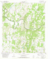
1980 Map of Bowser
USGS Topo · Published 1980About this map
The Colorado River carves a winding path through this central Texas landscape, marking the historical border where Mills and San Saba Counties meet. This 1970s-era topography reveals a rural district defined by deep hollows and intermittent drainages like Wilbarger Creek and Harky Hollow. Small community centers such as Bowser and Locker anchor the southern reaches, supported by local gathering places including Vargy Chapel and Oakland Church. The presence of several flowing wells and the Gravel Pit near the river suggests a reliance on the area's natural resources and subsurface hydrology. Notable elevations like Corn Knob and Cat Knob rise above the surrounding terrain, providing landmarks for a region where cattle ranching and sparse rural settlements have long shaped the land's character.
Find a feature on this map
42 named features on this map. Tap any name to fly to it.
Don’t see what you’re looking for? This feature index may not catch every label — zoom into the map to look around manually.
Map Details
Editions of this 1980 Bowser Map
This is the sole edition of this map. No revisions or reprints were ever made.
Other maps of this area

1885 · San Saba
USGS Topo · 1:125,000

1887 · Coleman
USGS Topo · 1:125,000

1889 · Brownwood
USGS Topo · 1:125,000

1889 · Coleman
USGS Topo · 1:125,000

1894 · Brady
USGS Topo · 1:125,000

1894 · Brownwood
USGS Topo · 1:125,000

1894 · San Saba
USGS Topo · 1:125,000

1925 · San Saba 2-a
USGS Topo · 1:48,000

1925 · Brady 1-a
USGS Topo · 1:48,000

1925 · Brownwood 3-d
USGS Topo · 1:48,000