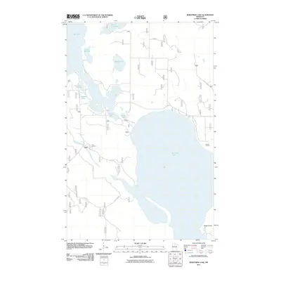
2011 Map of Bowstring Lake
USGS Topo · Published 2011About this map
Bowstring Lake dominates this northern landscape, its expansive waters surrounded by a network of smaller glacial lakes and rivers. The settlement of Inger is situated along the Bowstring River in the southwestern portion of the quadrangle, serving as a primary point of reference in this lake-rich region. The area's topography is marked by the presence of the Mesabi Range in the southeast, contrasting with the lower-lying wetlands and shoreline. Local history and genealogy are preserved at the Inger Cemetery and Donnelly Cemetery, located on opposite sides of the larger lake. A intricate web of forest and county roads, including Sand Lake Rd, Rainbow Rd, and Co Hwy 36, provides access to the numerous water bodies such as Mushgee Lake, Minni-Car-Car Lake, and Portage Lake, which characterize the Northwoods geography of Itasca County.
Find a feature on this map
23 named features on this map. Tap any name to fly to it.
Don’t see what you’re looking for? This feature index may not catch every label — zoom into the map to look around manually.
Map Details
Editions of this 2011 Bowstring Lake Map
This is the sole edition of this map. No revisions or reprints were ever made.
Other maps of this area

1919 · Max
USGS Topo · 1:62,500

1954 · Bemidji
USGS Topo · 1:250,000

1954 · Hibbing
USGS Topo · 1:250,000

1957 · Bemidji
USGS Topo · 1:250,000

1957 · Hibbing
USGS Topo · 1:250,000

1958 · Bemidji
USGS Topo · 1:250,000

1958 · Hibbing
USGS Topo · 1:250,000

1964 · Hibbing
USGS Topo · 1:250,000

1970 · Bowstring Lake
USGS Topo · 1:24,000

1970 · Deer River NE
USGS Topo · 1:24,000