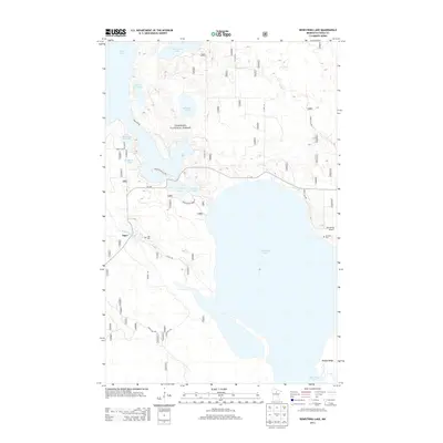
2013 Map of Bowstring Lake
USGS Topo · Published 2013About this map
Inger sits along the Bowstring River in this northern Minnesota landscape, surrounded by the dense woodlands of the Chippewa National Forest. The map is dominated by the sprawling waters of Bowstring Lake, a central feature for the local community and a significant water body within the Itasca County wilderness. Further north, a chain of smaller lakes including Birds Eye Lake, Mushgee Lake, and Sand Lake suggests a complex glacial geography. Cultural landmarks like the Inger Cemetery and Donnelly Cemetery provide points of interest for genealogists, while the Bowstring Airport and various Forest Service roads, such as Forest Road 2403, reveal the modern infrastructure required to manage these timberlands. The southern edge of the map begins to climb toward the Mesabi Range, indicating the transition toward the region's famed iron-bearing ridges.
Find a feature on this map
67 named features on this map. Tap any name to fly to it.
Don’t see what you’re looking for? This feature index may not catch every label — zoom into the map to look around manually.
Map Details
Editions of this 2013 Bowstring Lake Map
This is the sole edition of this map. No revisions or reprints were ever made.
Other maps of this area
1919 · Max
USGS Topo · 1:62,500

1954 · Bemidji
USGS Topo · 1:250,000

1954 · Hibbing
USGS Topo · 1:250,000

1957 · Bemidji
USGS Topo · 1:250,000

1957 · Hibbing
USGS Topo · 1:250,000

1958 · Bemidji
USGS Topo · 1:250,000

1958 · Hibbing
USGS Topo · 1:250,000

1964 · Hibbing
USGS Topo · 1:250,000
1970 · Bowstring Lake
USGS Topo · 1:24,000
1970 · Deer River NE
USGS Topo · 1:24,000