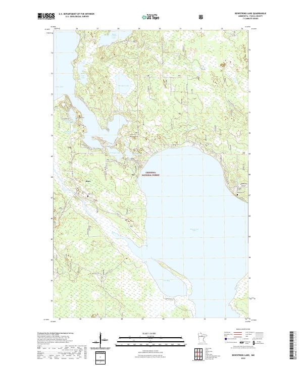
2022 Map of Bowstring Lake
USGS Topo · Published 2022About this map
Inger serves as a central hub for this portion of the Chippewa National Forest in Itasca County. The landscape is defined by its intricate water network, where the expansive Bowstring Lake and the Bowstring River dominate the eastern and southern reaches. Small, secluded water bodies like Mushyee Lake, Birds Eye Lake, and Minni Car Car Lake are scattered through the timberland, connected by a web of forest service and county roads.
Find a feature on this map
47 named features on this map. Tap any name to fly to it.
Don’t see what you’re looking for? This feature index may not catch every label — zoom into the map to look around manually.
Map Details
Editions of this 2022 Bowstring Lake Map
This is the sole edition of this map. No revisions or reprints were ever made.
Other maps of this area

1919 · Max
USGS Topo · 1:62,500

1954 · Bemidji
USGS Topo · 1:250,000

1954 · Hibbing
USGS Topo · 1:250,000

1957 · Bemidji
USGS Topo · 1:250,000

1957 · Hibbing
USGS Topo · 1:250,000

1958 · Bemidji
USGS Topo · 1:250,000

1958 · Hibbing
USGS Topo · 1:250,000

1964 · Hibbing
USGS Topo · 1:250,000

1970 · Bowstring Lake
USGS Topo · 1:24,000

1970 · Deer River NE
USGS Topo · 1:24,000