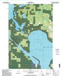
1996 Map of Bowstring Lake
USGS Topo · Published 1998About this map
Chippewa National Forest dominates this northern Minnesota landscape, where a dense network of water bodies and marshlands defines the local geography. The settlement of Inger sits near the banks of the Bowstring River, which flows into the expansive Bowstring Lake. This 1996 update, incorporating decades of topographic data from the U.S. Forest Service, reveals the managed nature of the timberland, indicated by numerous administrative boundaries and the Deer River Marcell Ranger District. Notable local landmarks include the Sand Lake Church and a solitary Cemetery on the eastern shore of Leech Lake. The map details a complex hydrologic system, connecting Sand Lake through various smaller basins like Mushgee Lake and Portage Lake, providing a clear view of the region's wilderness character and early industrial activity at the Gravel Pit.
Find a feature on this map
23 named features on this map. Tap any name to fly to it.
Don’t see what you’re looking for? This feature index may not catch every label — zoom into the map to look around manually.
Map Details
Editions of this 1996 Bowstring Lake Map
This is the sole edition of this map. No revisions or reprints were ever made.
Other maps of this area

1919 · Max
USGS Topo · 1:62,500

1954 · Bemidji
USGS Topo · 1:250,000

1954 · Hibbing
USGS Topo · 1:250,000

1957 · Bemidji
USGS Topo · 1:250,000

1957 · Hibbing
USGS Topo · 1:250,000

1958 · Bemidji
USGS Topo · 1:250,000

1958 · Hibbing
USGS Topo · 1:250,000

1964 · Hibbing
USGS Topo · 1:250,000

1970 · Bowstring Lake
USGS Topo · 1:24,000

1970 · Deer River NE
USGS Topo · 1:24,000