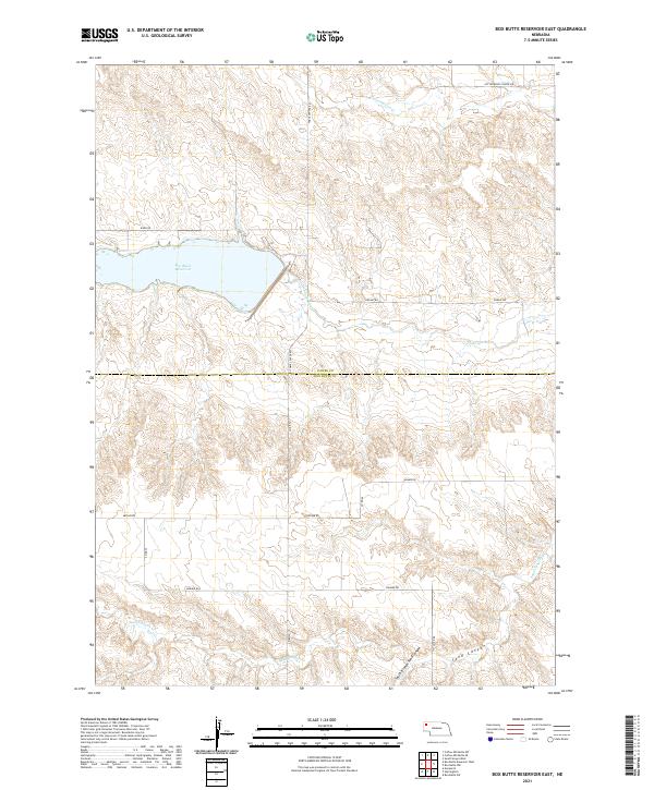
2021 Map of Box Butte Reservoir East
USGS Topo · Published 2021About this map
Box Butte Reservoir dominates this landscape on the border of Dawes and Box Butte counties, capturing the flow of the Niobrara River as it moves east. This high plains environment is defined by its drainage systems, including the winding Cottonwood Cr to the north and the complex erosional features of Sand Canyon and the South Branch Sand Canyon to the south. The human footprint is etched into the terrain through a grid of rural routes such as Table Center Rd and Banner Rd, which provide access to the vast ranchlands and agricultural plots characteristic of the Nebraska Panhandle. A notable site for local history is indicated by Cottonwood School Rd, signaling the location of a former rural educational hub in this sparsely populated region.
Find a feature on this map
22 named features on this map. Tap any name to fly to it.
Don’t see what you’re looking for? This feature index may not catch every label — zoom into the map to look around manually.
Map Details
Editions of this 2021 Box Butte Reservoir East Map
This is the sole edition of this map. No revisions or reprints were ever made.
Other maps of this area

1946 · Nonpareil
USGS Topo · 1:24,000

1946 · Box Butte Reservoir West
USGS Topo · 1:24,000

1947 · Box Butte NW
USGS Topo · 1:24,000

1948 · Box Butte Reservoir West
USGS Topo · 1:24,000

1948 · Hemingford
USGS Topo · 1:24,000

1948 · Nonpareil
USGS Topo · 1:24,000

1948 · Box Butte Reservoir East
USGS Topo · 1:24,000

1949 · Box Butte SW
USGS Topo · 1:24,000

1949 · Box Butte NW
USGS Topo · 1:24,000

1955 · Alliance
USGS Topo · 1:250,000