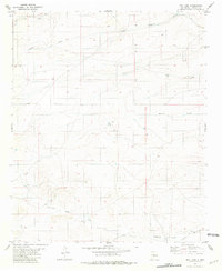
1981 Map of Box Lake
USGS Topo · Published 1981About this map
Arid drainage patterns and isolated water sources characterize this high-country New Mexico landscape during the early 1980s. The terrain is defined by a series of significant washes and arroyos, including Reventon Draw and Arroyo del Macho, which cut across the high plains. While the map is dominated by these seasonal watercourses, permanent water features and industrial markers provide critical points of reference for local geography. Horse Lake and Box Lake appear as distinct landmarks in a region where water management is vital, supported by subsurface exploration such as the 7-11 Well and a labeled Drill Hole. This 1:24,000 scale survey, field-checked by the U.S. Geological Survey in 1975, preserves the precise placement of ranching-era fence lines and section corners across Lincoln County, documenting a sparsely settled ranching landscape where infrastructure is limited to basic roads and essential watering holes like Lavade Draw.
Find a feature on this map
9 named features on this map. Tap any name to fly to it.
Don’t see what you’re looking for? This feature index may not catch every label — zoom into the map to look around manually.
Map Details
Editions of this 1981 Box Lake Map
This is the sole edition of this map. No revisions or reprints were ever made.
Other maps of this area

1934 · Capitan
USGS Topo · 1:48,000

1935 · Capitan Mountains
USGS Topo · 1:48,000

1937 · Capitan
USGS Topo · 1:62,500

1940 · Capitan Mountains
USGS Topo · 1:62,500

1955 · Roswell
USGS Topo · 1:250,000

1958 · Roswell
USGS Topo · 1:250,000

1962 · Roswell
USGS Topo · 1:250,000

1973 · Jacob Spring
USGS Topo · 1:24,000

1973 · Chupadero Mountain
USGS Topo · 1:24,000

1973 · Jicarilla Peak
USGS Topo · 1:24,000