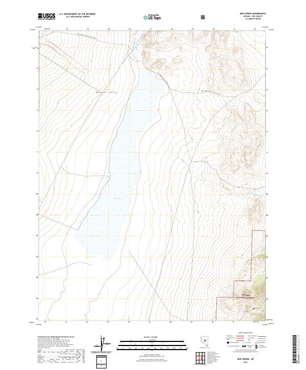
2021 Map of Box Spring
USGS Topo · Published 2021About this map
Monitor Valley defines the western expanse of this high-desert landscape, where the seasonal waters of Dry Lake occupy the central basin. This 2021 survey illustrates a remote segment of the Great Basin, characterized by the stark contrast between the flat lakebed and the rising slopes of the Toiyabe National Forest in the southeast. The hydrology of the area is centered on Box Spring in the north and the intermittent flow of Wadsworth Cr, which descends from the eastern highlands toward the valley floor.
Find a feature on this map
15 named features on this map. Tap any name to fly to it.
Don’t see what you’re looking for? This feature index may not catch every label — zoom into the map to look around manually.
Map Details
Editions of this 2021 Box Spring Map
This is the sole edition of this map. No revisions or reprints were ever made.
Other maps of this area

1926 · Roberts Mountains
USGS Topo · 1:250,000

1929 · Roberts Mountains
USGS Topo · 1:250,000

1955 · Millett
USGS Topo · 1:250,000

1956 · Tonopah
USGS Topo · 1:250,000

1959 · Tonopah
USGS Topo · 1:250,000

1959 · Millett
USGS Topo · 1:250,000

1960 · Dianas Punch Bowl
USGS Topo · 1:62,500

1960 · Wildcat Peak
USGS Topo · 1:62,500

1962 · Tonopah
USGS Topo · 1:250,000

1971 · Mosquito Creek
USGS Topo · 1:24,000