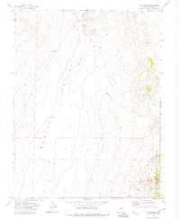
1971 Map of Box Spring
USGS Topo · Published 1974About this map
Monitor Valley dominates this high-altitude interior Nevada landscape, where the wide desert floor meets the rising slopes of the Toiyabe National Forest. The 1971 survey highlights a reliance on scarce water sources in this arid region, centering on Box Spring and other scattered springs that likely served as vital landmarks for local ranching operations or travelers. The terrain is defined by the significant presence of Dry Lake, a seasonal drainage feature characteristic of the Great Basin's endorheic basins. Evidence of early 1970s land use and access is visible through a network of jeep trails and the path of Wadsworth Creek, which carves through the eastern topography. The map illustrates a transitional zone where flat valley grazing lands meet the more complex, timbered heights of the national forest boundary.
Find a feature on this map
11 named features on this map. Tap any name to fly to it.
Don’t see what you’re looking for? This feature index may not catch every label — zoom into the map to look around manually.
Map Details
Editions of this 1971 Box Spring Map
This is the sole edition of this map. No revisions or reprints were ever made.
Other maps of this area

1926 · Roberts Mountains
USGS Topo · 1:250,000

1929 · Roberts Mountains
USGS Topo · 1:250,000

1955 · Millett
USGS Topo · 1:250,000

1956 · Tonopah
USGS Topo · 1:250,000

1959 · Tonopah
USGS Topo · 1:250,000

1959 · Millett
USGS Topo · 1:250,000

1960 · Dianas Punch Bowl
USGS Topo · 1:62,500

1960 · Wildcat Peak
USGS Topo · 1:62,500

1962 · Tonopah
USGS Topo · 1:250,000

1971 · Mosquito Creek
USGS Topo · 1:24,000